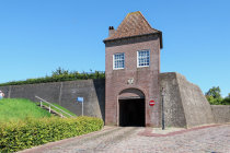
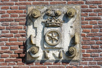
Heusden's coat of arms is shown above the Wijkse Poort
This "reconstruction" of Heusden Castle dates from 1987, most people find it an utterly failure
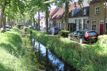
this is the Demer, a small ditch dating back to 1347 that runs through town
many of the original houses are restored
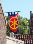
a flag with Heusden's coat of arms
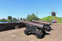
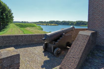
these old guns protect the harbor, in the background Molen II, one of the 3 remaining (restored) mills
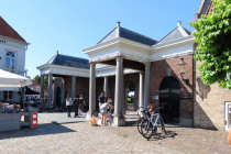
the neo-classical Visbank from 1796 connects the Vismarkt with the harbor
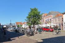
this is the Vismarkt, once a fish market, now the culinary center of Heusden
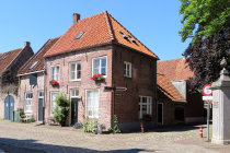
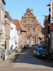
a typical street view
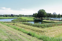
the fortifications on the south side include an artificial island
the old fortified city of Heusden
The fortified town of
Heusden sits at the south bank of the
Meuse,15 km east of Brabant's capital 's Hertogenbosch.
First mentioned
in documents from 722, Heusden has a long and often violent history, ranging from a devastating Viking raid in 839 to the
blowing-up of
the monumental City Hall by retreating German forces in 1944.
Heusden Castle was built around 1250 and dominated the town till
in 1680 lighting struck the gunpowder in the donjon. The castle was instantly turned into a ruin.
The Dukes of Holland, Brabant
and Gelre all claimed ownership of Heusden until in 1357 Holland won and it was not before 1810 that the city became
part of Brabant again.
In the 19th century the city lost its military importance and the fortifications
slowly deteriorated.
Starting in 1968, Heusden was restored to the situation of 1646, including mills, bastions, ravelins
and wet moat.
We visited a sunny Heusden in June 2022.
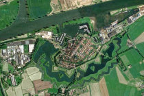


Google Maps nicely shows Heusden's layout, south of the River Meuse
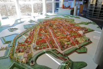
A maquette of Heusden is on display inside the new City Hall
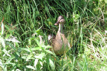
a duck guards the Demer
the Wijkse Poort, a restored version of one of the 4 original city gates
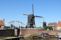
Molen I and the drawbridge that yields entrance to the harbor
atop the Wijkse Poort you have a nice view of the bastions and islands