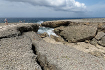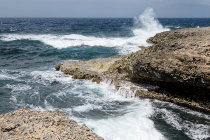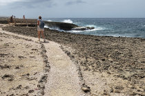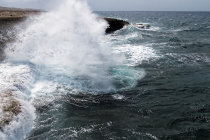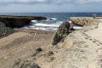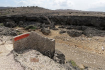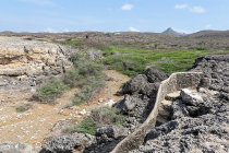
at the natural gully of Boka Wandomi people have rearranged the pebbles a bit
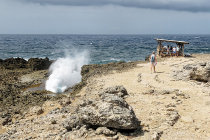
at Boka Pistol there is a covered lookout to shelter from the relentless sun
further along the trail there is a viewpoint above the sea
a wave makes it into the cave
an easy trail leads along the cave at Boka Tabla, where you can enjoy the incoming waters head-on
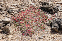
despite the barren surroundings, life always finds a way
Shete Boka National Park 2026

The Caribbean Sea continuously pummels the northeastern coastline of Curacao with large, rolling waves.
Especially near caves and inlets it creates spectacular images of high-splashing water, accompanied by loud noises and even bangs.

In the Shete Boka National Park, established in 1994, about 10 km of the barren coastline is protected. Shete Boka means seven inlets, but the park encompasses at least 10 inlets.
Paths lead to four Bokas where you can enjoy the raw power of nature.

With the scorching sun and high temperatures, it is advisable to travel the unpaved road between the Bokas by car.

- At Boka Pistol, the sea crashes into a small crevice with the sound of a gunshot.
- Boka Kalki has a small beach where protected sea turtles like to lay their eggs.
- At Boka Tabla, you can see the waves coming straight at you from inside a kind of cave, and there is a terrace where you can view the waves from above.
- Boka Wandomi sports a beautiful viewpoint, and, via steep stairs and a natural gully, you arrive at a fragile natural bridge.

We visited Shete Boka in May 2026.
website795053.jpg website795052.jpg website795051.jpg website795050.jpg website795049.jpg website795048.jpg website795047.jpg website795046.jpg website795045.jpg website795044.jpg website795002.gif website795042.gif website795041.gif
1
2
4
5
6
7
8
9
10
end
website795003.gif website795001.gif
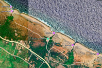
a Google Maps view of Shete Boka National Park with the 4 main Bokas
website795002.gif website795003.gif website795002.gif website795001.gif
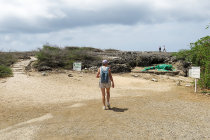
a the entrance of the park, visitors are welcomed by a huge green iguana
3
website795003.gif website795002.gif website795001.gif website795003.gif website795002.gif website795001.gif website795003.gif website795002.gif website795001.gif
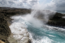
where waves smash against the limestone rocks
website795003.gif website795002.gif website795001.gif website795003.gif website795002.gif website795001.gif website795003.gif website795002.gif website795001.gif
with the sound of a pistol shot the wave bangs onto the cliff
website795003.gif website795002.gif website795001.gif website795003.gif website795002.gif website795001.gif website795020.gif website795019.jpg website795018.jpg website795017.jpg website795016.jpg
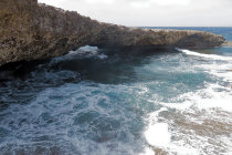
the limestone rock arch is fragile and not accessible
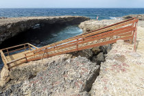
wooden stairs leads you to a natural bridge
you have to scale these two steep stairs to cross the gully
11
12
13
14
website795003.gif website795002.gif website795001.gif website795003.gif website795002.gif website795001.gif website795003.gif website795002.gif website795001.gif website795003.gif website795002.gif website795001.gif
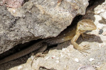
it is hot, even for this female Curacao Whiptail Lizard. Locals call it a Lagadishi
website795007.jpg website795006.jpg
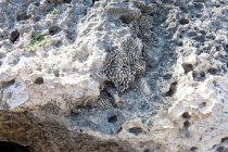
an ancient coral formation embedded in the limestone rocky soil
15
website795003.gif website795002.gif website795001.gif
16
heading back you have a nice view of Mount Christoffel, at 372 meters Curacao's highest poinrt
website795003.gif website795002.gif website795001.gif